So good!:
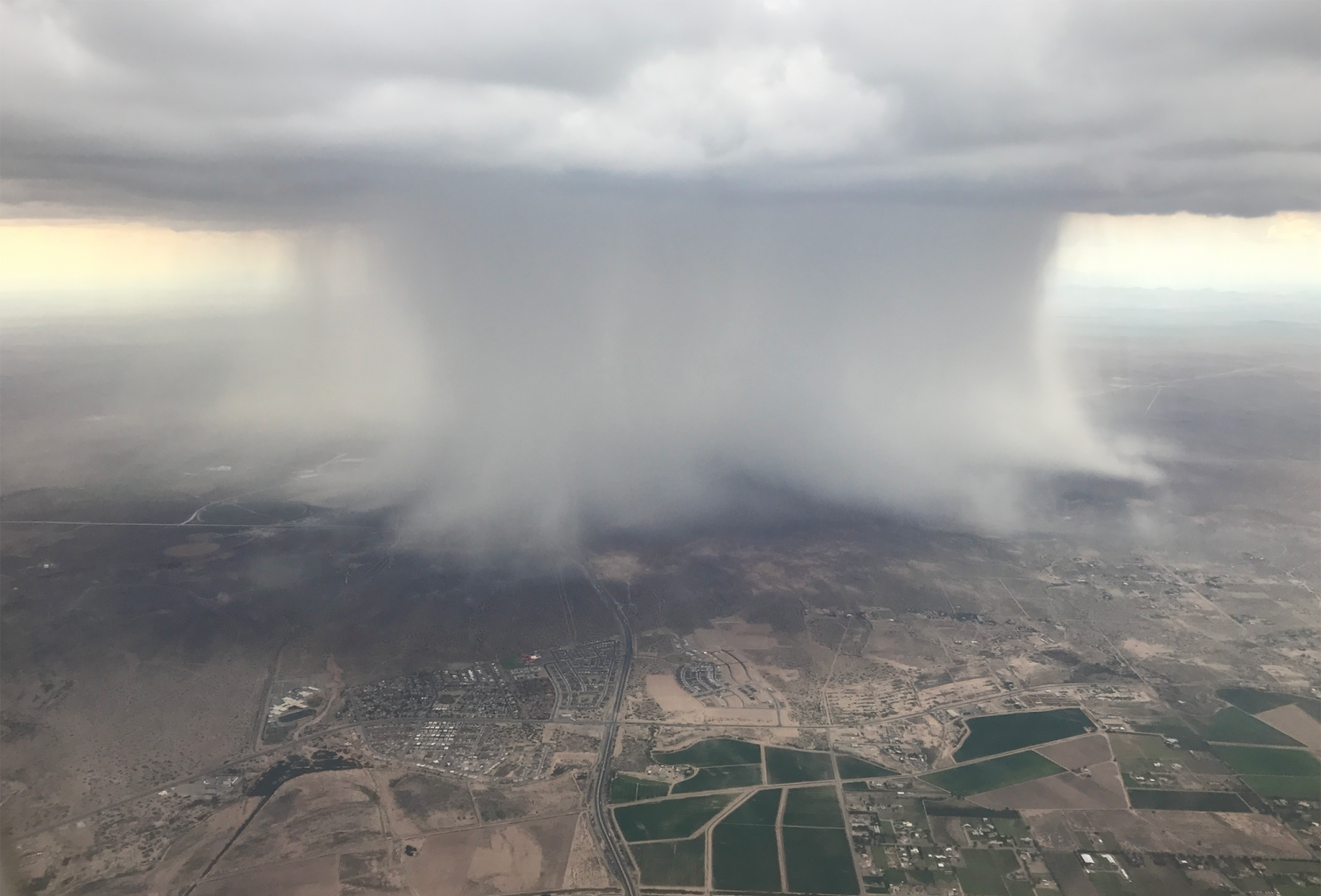
The image speaks for itself; it is an astounding shot of the microburst at the exact moment it crashed down from the heavens — 4:34 PM Mountain Daylight Time on Wednesday, over El Paso. The local National Weather Service office found itself in the bull’s eye, with one meteorologist scrambling up to a nearby mountain to snap some other shots of the colossal downburst.Microbursts are so dangerous. I recall reading about an airliner takeoff in Tucson in 1976. A microburst hit the runway during takeoff roll. The airliner couldn't gain altitude at first in the downdraft, and actually hit power lines. Then it reached the edge of the downdraft, with its curlicue of rising air, and was saved.
The photo above, captured from a plane by El Paso resident Alfredo Maldonado, is gorgeous; it shows the rush of air dropping to the ground and fanning out in all directions. “I was flying from El Paso to Denver,” Maldonado said. “The flight was on time. It was smooth — no turbulence whatsoever, no wind, no rain.”
But just a few miles away, Maldonado spotted what appeared to be a plume of “water dumping from the sky.”
“I had never seen something so isolated,” he said. His children had the window seat, but he immediately thought to snap this picture — and the weather community is extremely glad he did.
“Just seeing the raw power of Mother Nature was incredible. We could see what almost looked like little waves or ripples where it was hitting the ground,” Maldonado said. “It’s been rainy for the past week, which is always a relief in the desert. Usually we can see where the storms are hitting, and some have flash floods, so these are known to come with force, but this one looked different.”
No comments:
Post a Comment